
- Prologue
- G7/P5: Indian Monsoon Mechanism & seasons of India
- G7/P6: Climatic regions of India
- G7/P7: Water resource in India: Surface vs. Ground
- G7/P8: India- Floods, Droughts & Watershed Management
Prologue
- These geography lectures are conducted by Ms. Rajtanil at Sardar Patel institute of Public Administration (SPIPA), Ahmedabad.
- On 16th March, continuation of the Indian geography segment with water and climate related topics. Total ~2:30 hours but I’ve split it into four parts.
- PowerPoint of the lecture, available at Mrunal.org/Download
- Medium of instruction- Hindi.
- English version not possible for the moment, because faculties are required to teach at this batch, in Hindi/Gujarati only. Besides, same content is available in English in the powerpoints.
G7/P5: Indian Monsoon Mechanism & seasons of India
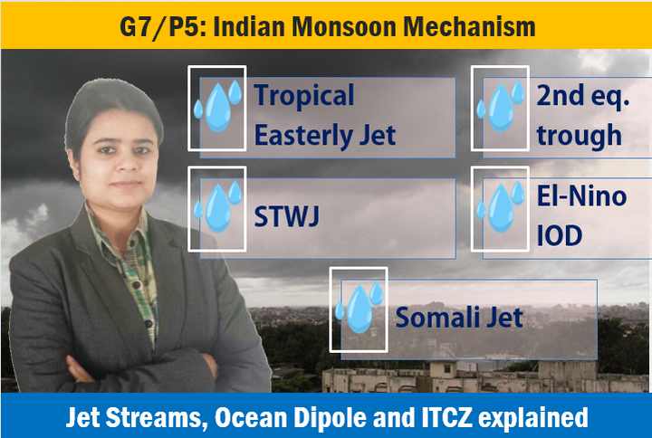
- Indian monsoon: unique features, mechanism
- Tropical easterly Jet
- Pressure system of earth
- Second equatorial trough
- Somali Jet and Somali current
- Permanent Jet stream on earth
- Sub-tropical westerly Jet: winter, early summer and monsoon
- Indian Ocean Dipole and El-Nino.
- Reasons for Fluctuation in Monsoon: ITCZ, second equatorial trough, sub-tropical westerly Jet, Tibetan plateau, Mascarene High, El-Nino
- Onset of Monsoon: two branches: Arabian branch and Bay of Bengal branch
- Arabian branch: western Ghats, Arvalli and Arabian Branch
- Bay of Bengal/ eastern branch: Eastern Ghats, chhota Nagpur plateau and central highlands and Purvanchal.
- Rainfall pattern of India
- Retreating Monsoon and tropical cyclone
- Winter rainfall on TN coast
- Winter: western disturbances in north India
- Summer season: pre-monsoon showers
Youtube Link: https://youtu.be/gUHto7ASd8Q
G7/P6: Climatic regions of India

- Climatic regions of India – division by Trewartha (Symbols)
- Types of Natural vegetation in India
- Tropical forest: 2 types-Moist and dry
- Tropical wet-evergreen forest
- Tropical semi- wet-evergreen forest
- Tropical Moist deciduous forest
- Tropical Dry forest: 3 types-Dry evergreen, dry deciduous, tropical thorn
- Tropical Dry evergreen forest
- Tropical Dry Deciduous forest
- Comparison : tropical moist deciduous, Tropical dry deciduous and tropical thorn
- Tropical thorn
- Montane forest: 2 types-Subtropical and Temperate forest
- Montane subtropical forest: 3 types-Sub-tropical broad leaved,Subtropical- moist pine,Sub-tropical dry evergreen
- Rainfall pattern in Montane sub-tropical forest
- Sub-tropical broad-leaved forest
- Sub-tropical moist-pine forest
- Sub-tropical dry evergreen forest
- Montane Temperate forest: 3 types-Wet Temperate,moist Temperate,dry Temperate
- Rainfall pattern in Montane temperate forest-Wet, Moist and Dry
- Alpine forest
- Forest-type and area
- UPSC Prelims 2010 question
Youtube Link: https://youtu.be/2a6XtVJkv-c
G7/P7: Water resource in India: Surface vs. Ground

- Surface water resource of India: Comparison between Himalayan rivers and Peninsular rivers
- Telangana plateau – water resource
- Ground water resource: Meaning of water table
- 4 regions of ground water reserves in India: alluvial plains, Bhabhar, East-west coastal plains, Peninsular blocks
- Ground water reserve in river basin: descending order
- Ground water usage: descending order
- Ground water usage: urban and rural
- Tube-well usage: state-wise
- Present availability of ground water
- Ground water-pollution
- Artificial recharge and rainwater harvesting technique to conserve ground water reservoir
- Issues related to water resources
Youtube Link: https://youtu.be/yGdV5DxHdf0
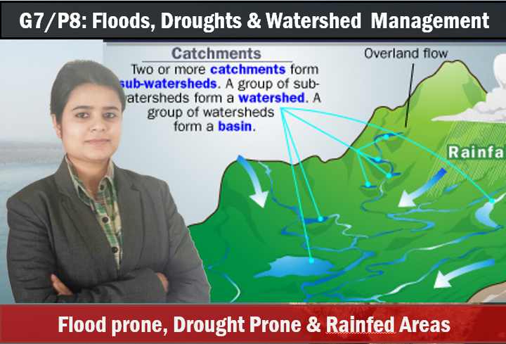
G7/P8: India- Floods, Droughts & Watershed Management
- Flood: meaning, natural reasons, anthropogenic reasons, flood prone areas in India
- Flood solution: administrative and Ecological
- Drought: Areas affected
- Problems of drought and agrarian poverty
- Small-drought preventing techniques
- Drought-prone areas vs. rainfed areas
- Importance of rainfed areas in India
- Watershed management: meaning, components, check-dams, afforestation
- Time-line of watershed development in India and case studies
- Agro-practice, crop choices and irrigation choice for drought-prone areas
- Drought-prone area development plan
- Agro-forestry
- precap of next lecture: soil types and land usage pattern.
Youtube Link: https://youtu.be/p37ad1xdEII
Visit youtube.com/user/TheMrunalPatel For more lectures on UPSC General Studies.
![[Summary] Budget & Economic Survey 2018 Gist for the UPSC IAS/IPS Interviews](https://mrunal.org/wp-content/uploads/2018/02/c-bes18-basanti-500x383.jpg)
![[BES171] Banking-Classification: Wholesale Banks, Cooperative Banks, DFI AIFI, MUDRA Bank, Islamic Bank, NBFCs & Indigenous Moneylenders](https://mrunal.org/wp-content/uploads/2017/05/c-bes171-evo-2-500x383.gif)
![[BES171] Banking-Classification: RBI Structure Functions, Nationalization, Scheduled Banks, Merger of SBI Associate Banks & BMB, Private Banks, SFB & Payment Banks](https://mrunal.org/wp-content/uploads/2017/02/c-bes171-cover-500x383.gif)
dear mrunal sir
firstly i heartly appriciate of your good work on this field . I also thanks to all your team mate who has been working non stop .
Hatsoff mam…keep up good work. .,..many students are benifiting from these lecturers..
I have a doubt regarding tropical easterly jet(TEJ). As explained by Ma’am,its path is from somalia to tibetian plateau. however, in many places, the tropical easterly jet has been named the African Easterly jet and flows parallel to latitutes over northern africa. Moreover, the path as given by rajtanil ma’am does not indicate easterly origin. please clarify!! @mrunal sir, @rajtanil ma’am. @ANYBODY!
thanks
Sir, The links have become inaccessible for geography powerpoints after the overhaul of website!